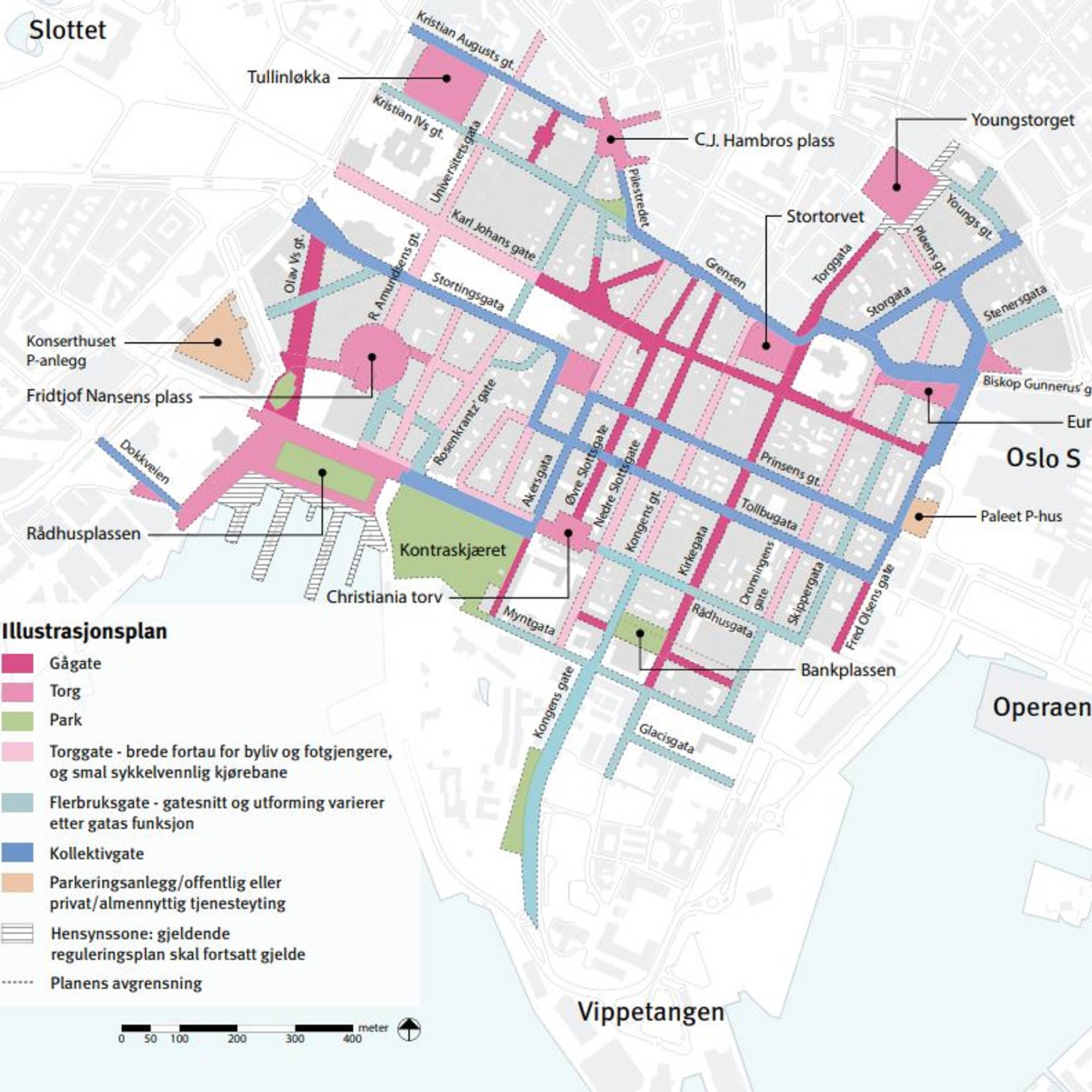
That street in particular has been closed for all traffic except buses and trams (and necessary service cars I guess, like the parked van on street view). On [1] you can see Stortingsgata labeled in blue as "kolletivgate" (collective street). As the graphic shows most streets at the very core of the city have been closed to general traffic, the bluish streets are mostly only public transportation and the pinkish streets are mostly pedestrian and bike lanes. Outside the core you see more cars on the roads.
There's likely no space for cars (e.g. parking), since it's an old city center. If there is, it's expensive. People that live in older city centers usually don't have a car, a bicycle and public transit gets them far enough.
https://goo.gl/maps/Pxh1QRzRgdn5Lrhc6